For generations, communities across India have shaped and cared for the ecosystems around them—forests, wetlands, grazing lands, rivers, coasts, and water bodies—through shared cultural practices, customary rules, and ecological knowledge passed down over time. These systems of collective care and governance have sustained livelihoods, supported biodiversity, and maintained the collective relationships between people and the ecosystems they depend on.
Yet much of this knowledge exists outside formal systems. Many of these ecosystems, especially those governed as commons, remain poorly mapped, legally ambiguous, and weakly documented in administrative records. Nearly 25 years have passed since India’s last comprehensive assessment of common lands in 1998. In the time since, estimates suggest a loss of between 1 and 32 percent of common lands across various districts.
These gaps in data and documentation leave information and knowledge about these ecosystems fragmented across administrative records and formal planning systems. Community-held knowledge of seasonal rhythms, boundaries, and ecological histories is rarely referred to by these systems. As a result, many commons are becoming increasingly vulnerable to encroachment, degradation, and mismanagement.
As ecological pressures intensify—from water scarcity and flooding to coastal erosion and resource depletion—the need for more participatory and accessible forms of ecological data including community-generated records, local ecological knowledge, and oral histories, has become increasingly urgent.
Making data work as a tool for participation
For data to support community-led ecological governance, it cannot remain a static record. It needs to become something that different stakeholders, including local governments, civil society organisations, and communities, can contribute to, access easily, interpret, and use.
Aaditeshwar Seth, co-founder of CoRE Stack, a digital public infrastructure initiative that enables communities to plan and manage their landscapes, explains that data plays two important roles when it is in the hands of communities. It supports decision-making by helping identify what actions need to be taken and when. At the same time, it also helps initiate conversations and dialogue by providing historical information that allows people to reflect, question, and plan together. Digital trails thus created through data represent the conversations and decisions made by communities, which can be referred back to for strengthening local governance and social accountability.
This approach is reflected in tools developed as part of CoRE Stack. One example is Commons Connect, an Android-based participatory application that combines community knowledge with geospatial data. The platform enables local stewards to map, plan, and manage natural resources.
In the tribal regions of Jharkhand, where the PESA Act is in effect, SUPPORT, a nonprofit working with marginalised communities, uses the platform to gather community inputs and prepare data-backed proposals ahead of Gram Sabha meetings.

Across villages in Dumka, one of the districts where this is active, Commons Connect has led to data-backed proposals for water conservation, irrigation, plantations, and livelihoods by helping to standardise proposal formats. It has also reduced reliance on external technical support and strengthen ownership through more transparent data sharing.
This shows that when knowledge of the commons is accessible to people, it strengthens their ability to engage with governance processes. Data, in that sense, becomes a tool that supports more informed and participatory decision-making.
Data as a tool for assertion
This can also take the form of communities using data not just to access information, but to question and reshape how decisions about the use of natural resources.
Take the example of the 2012 amendment to the Forest Rights Act, which introduced GIS-based mapping to support the recognition of community forest rights. While officials were meant to help gram sabhas map customary forest boundaries, the technology was often used to reinterpret and reduce the extent of land being recognised.
In Kalahandi district, villages responded by undertaking their own GPS-based mapping. Community members walked the full extent of their forest boundaries to generate evidence that could stand up within formal systems. By producing and using their own data, they were able to challenge inaccuracies and assert a greater role in how these forests are governed.
This shows how data can help communities to move from being mere users of shared resources and related policies, to becoming active stewards who engage more effectively with institutions.
Data as a tool for representing lived knowledge
Even when data enables participation and supports collective decision-making, an important question remains: What does it make visible, and what does it leave out?
Much of what defines the commons, customary boundaries, seasonal use, and ecological knowledge, often remains undocumented or excluded from formal records. Making these ecosystems visible is not just a technical exercise. It requires bringing together different forms of knowledge, geospatial data, administrative records, and lived, place-based understanding, so that the commons can be seen and understood more fully, shaped by the knowledge of those who live around them
In Chhattisgarh, Baiga Adivasi communities, for instance, have mapped their food forests, seasonal resources, and fire patterns. Working across villages, community members mapped forest areas using traditional names and tracked the availability of pulses, leafy vegetables, medicinal herbs, and other resources across seasons.
By identifying resources that were becoming scarce, communities became more intentional about protecting them.
This process helped communities identify ecological shifts that were otherwise difficult to track in formal systems. Community members documented the decline of traditional crop varieties and medicinal plants linked to changing rainfall patterns, forest degradation, and shifts away from traditional cultivation practices. The mapping also strengthened conservation efforts. By identifying resources that were becoming scarce, communities became more intentional about protecting them, while collective monitoring helped reduce forest fires and improve stewardship of local ecosystems.
In doing so, the process transformed lived and oral knowledge into something communities could collectively discuss, update, and act upon. It also made visible forms of ecological knowledge and governance that are often absent from official records and planning systems.
In this way, data does not just record the commons. It also shapes how people understand them, whose knowledge is recognised, and how decisions are made.
Making data work for the commons
For policymakers and practitioners working to strengthen data-driven governance of the commons, the focus must shift to how data works in practice. It needs to be embedded in everyday decision-making, accessible to different users, and supported by systems that enable its use.
1. Anchor data in everyday decision-making
As Madhusoodanan CG, the co-founder of EQUINOCT Community Sourced Modelling Solutions, a climate innovation and modelling organisation, notes, people engage with data when it helps solve immediate problems. “If a tool or information does not address farmers’ immediate problems, such as flooded fields or water scarcity for crops, they are unlikely to engage with it. It is therefore important to clearly identify and articulate the collective problem the tool aims to address,” he says.
In Kerala’s Ernakulam district, where tidal flooding disrupts everyday life, for example, EQUINOCT has developed SeaSight, a web platform for tidal flood forecasting and visualisation. Built in collaboration with local governments and communities, the platform integrates scientific modelling with local inputs to support planning, early warning, and response. This has included participatory mapping and community-led flood monitoring—often led by women of affected panchayats from the Kudumbashrees network—to document when and where flooding occurs and inform local action plans in panchayats such as Ezhikkara.
Tools designed for long-term projections and complex analysis play an important role for researchers and policymakers. At the same time, when data can also support day-to-day decision-making at the local level, it becomes more actionable for communities managing shared landscapes and resources.
2. Work through local governance systems
For data to be trusted and sustained, it must be embedded within existing governance structures. Panchayats and local institutions play an important role. They help in validating the data, making sense of it, and eventually, acting on it.
Working through these systems ensures that data is not seen as external, but as part of established decision-making processes. It also strengthens accountability by linking data to formal channels where decisions are made and implemented.
“We had to work very closely with the elected representatives at the Panchayat level and the district authorities to ensure that the warnings on tidal flooding reach the people on a timely basis. Also, working with the local panchayats helped us build trust within the community,” says Madhusoodanan.
This is reflected in how data on high-tide flooding in Ernakulam was mobilised through governance processes. EQUINOCT worked with panchayats, district authorities, and local communities through Gram Sabhas and forums such as the Conference of Panchayats. At the first such convening in January 2025, elected representatives, district officials, and line departments came together to collectively engage with evidence on tidal flooding, resulting in a set of shared priorities to address tidal flooding as a climate-aggravated risk within planning processes. These continued and consistent community efforts through various forum and evidence creation finally resulted in the declaration of high-tide flooding as a state-specific disaster in Kerala in January 2026.
By embedding these processes within governance systems, data becomes more useful. It supports planning, preparedness, and long-term adaptation.
At the same time, different levels of governance need to work together. This helps ensure that locally generated data is recognised by administrative systems. It also allows the data to inform implementation.
3. Design for accessibility and inclusion
Access to data and the ability to interpret and act on it, cannot remain limited to a small group of technical experts. Differences in digital literacy, language, and connectivity often shape who can engage with data and how, making it critical to design systems that are inclusive in practice, not just in intent.
As Aaditeshwar of CoRE Stack notes, “not everyone is data literate.” He adds that for data to enable people to see, discuss, and demand, it must be made usable, and not just available, in ways that reflect how communities engage with information in everyday contexts.
Accessibility is not only about collecting or sharing data, but also about making it easier to interpret.
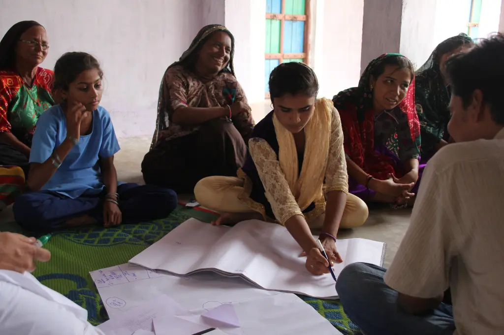
At CoRE Stack, they are addressing this by working with networks of landscape stewards—community resource persons and volunteers who act as intermediaries between data systems and local communities. Using tools such as Commons Connect, these stewards facilitate village-level meetings, work with communities to map local resources and identify needs and translate these into data-backed proposals that feed into Gram Sabha and Panchayat planning processes.
In doing so, they help bridge the gap between data and decision-making. This approach decentralises expertise, Aaditeshwar claims. Data collection and use no longer depend only on a small group of technical experts, but can increasingly be carried out by trained community actors, while experts provide support from a distance.
At the same time, accessibility is not only about collecting or sharing data, but also about making it easier to interpret. Organisations such as Tarkam are working on simplifying data visualisations and translating complex datasets into formats that communities and local institutions can engage with more easily. This includes working with data generated through platforms such as CoRE Stack and presenting it in ways that support local discussions, planning, and decision-making.
Designing for accessibility, then, is not only about user-friendly tools, but also about enabling broader participation in how data is produced, understood, and used.
4. Build open and collaborative data ecosystems
Expanding access is only one part of the equation. For data to be truly useful, it must also move across actors and systems. This requires building shared and interoperable data ecosystems, where information can be understood and applied collectively.
For commons-related work, this challenge is even more critical. Data relevant to ecosystems and their governance already exists across government departments, public databases, community records, and organisation-led research. However, these datasets often remain fragmented and disconnected, making it difficult to interpret ecological changes or apply insights across landscapes and governance systems. Decisions about resources often span landscapes and administrative boundaries. Yet granular information, such as Panchayat-level plans, rarely links to broader trends at the watershed or resource level. Similarly, existing datasets—like groundwater changes or land-use shifts—are not systematically connected to provide a complete picture of the commons.
This fragmentation makes it hard for data to be understood, shared, or used effectively by all stakeholders, including civil society groups, research organisations, and the communities themselves.
You need dictionaries, some common language, so that one dataset can talk to another.
“There is a lot of data that organisations already have, and often a willingness to share it. But it’s not always clear what they get in return, or how to make that data usable across different contexts. As a result, much of it remains underutilised,” notes Anand Sahasranaman, co-founder of Tarkam, an organisation working to strengthen data use and data-driven discourse in the social sector.
This is where the design of data systems becomes critical. At Tarkam, efforts to address this are increasingly focused on interoperability and creating ways for different datasets to “talk” to each other. This includes building shared standards such as data dictionaries, which document how data is collected, what it represents, and how it can be used. “We may not be able to achieve full standardisation, that people follow the same naming conventions, units, and ways of collecting data, but you do need dictionaries, some common language, so that one dataset can talk to another,” shares Sruthi Krishnan, another co-founder of Tarkam.
At the same time, strengthening data ecosystems also requires investing in people and capabilities. Many organisations lack the bandwidth or expertise to analyse or apply it. Building a cadre of trained data stewards—individuals who can support both data collection and use—can help bridge this gap, making data more actionable across contexts and allowing insights on the commons to travel beyond isolated projects.
As we think about how commons are understood, governed, and sustained, data becomes central to the conversation. It is not just as a technical resource, but as a shared foundation for decision-making across communities, governments, and other stakeholders. When commons are made visible, when data is relevant to everyday contexts, and when access to information is more widely distributed, it can support more informed actions and strengthen accountability.
—
Know more
- Read this article to learn more about how geospatial tools are being used to map and govern the commons in India.
- Read this paper to further understand the role of participatory mapping and data in commons governance.
Do more
- Explore SPREAD’s work on commons mapping in Odisha to see how communities are documenting and visualising shared resources.